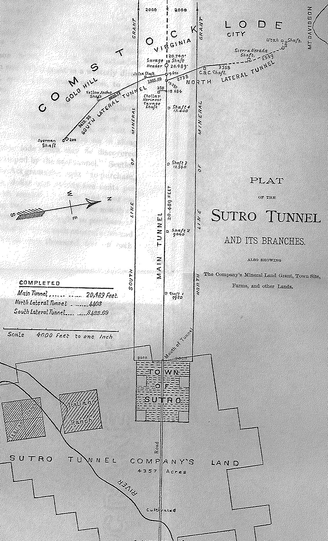
The Official Sutro Tunnel Plat Map
Virginia City, Nevada
The Sutro Tunnel consisted of a main tunnel and side tunnels. The main tunnel was 3.88 miles long, and the side tunnels were 2.42 miles long.
The total tunnels of the Sutro Tunnel system totaled 6.30 miles.
This map below was found folded within a small, hardbound book, The Sutro Tunnel Company and The Sutro Tunnel: Property, Income, Prospects and Pending Litigation, Report to the Stockholders, by Theodore Sutro, attorney and counsellor for the Sutro Tunnel Company, New York, July 1887.
The book is part of the archives of Western States Jewish History Association.
The Sutro Tunnel ran from the Comstock Lode at Virginia City downhill to the town of Sutro, where Adolph Sutro laid out farm plots in the arid land and watered them with water drained from the mines. The fresh produce grown there was sold in Virginia City.
Source
- Norton B. Stern, “Adolph Sutro, Pioneer Jews of San Francisco, Part Two, M-Z,” Western States Jewish History 41/2.
For more on Sutro and his tunnel in Virginia City, click here.
For Sutro’s philanthropic life in San Francisco, click here.
- Plat of the Sutro Tunnel and its Branches